West to Montana
This September, after a more normal Cedar Rapids year (post-derecho, post-COVID, post-surgeries) we headed to the American Prairie Reserve in Montana which we help support. Our compact equipment fit nicely in the Subaru as we headed out on Highway 30. That gave us a great view of wind turbines, especially in western Iowa. We threaded our way up to and through Sioux City to I-90 and crossed South Dakota, pausing at eye-catching rest stops.
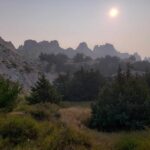
The Badlands were smoky from Canadian wildfires the first night we camped but cleared some by the next morning. The spacious tent sites were pleasant, and our lifetime National Park senior passes came in handy.
- Canadian wildfire smoke.
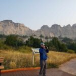
- Smoke drifted off overnight.
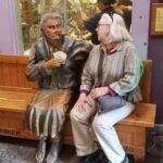
- Author “visiting” with wooden Wall Drug statue.
We enjoyed the Badlands loop and then just had to stop at iconic Wall Drug and walk through without succumbing to the enticements. We didn’t get ice water but had coffee instead.
The Bighorns in Wyoming.
Such unusual names like Crazy Woman Creek and the Tongue River, had us speculating what might be behind those names. As we passed through the Crow Reservation we thought about the contrasts between Reservation land, with less arable soil, and non-Reservation lands and settlements. The Crow land is large. We noticed some fields with square bales compared to the large, round bales on non-reservation ranches.
The Bighorns loom in the distance.
The second night found us camping in a private campground in southeast Montana north of the reservation. Most private campgrounds are geared toward huge RVs and camping trailers, with few tent spaces. However, we secured a tent spot by a stream and enjoyed showers.
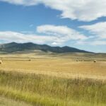
The land changed radically in Montana. Rocky hills with huge hayfields, grazing cattle, and beehives dominated. We saw some sorghum and sunflower fields.
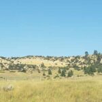
- Montana is a mix of agriculture and steep hills.
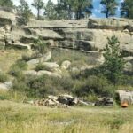
- Tenting among rocks.
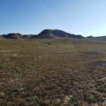
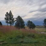
- Montana’s varied landscape
American Praririe Reserve
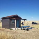
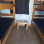
We headed west and then north on US 191 to our cabin on the American Prairie Reserve (APR). Small cabins with bunk beds and storage space were seven miles north of the Missouri River. Although we have tent camped many times in bear and cougar country, we were glad to have a rustic cabin. Along with four cabins, there were also about twelve primitive camping sites. We cooked outside.
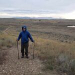
The well for potable water, with high mineral content, was 2,000 feet deep. We used community showers, toilets, two sinks, and a dishwashing sink/drainer which were very thoughtfully spaced and planned. By hiking trails near the cabins, we learned about prairie ecosystems – grasslands, soil and water, bugs, birds, and animals. As we hiked around the area, prairie dogs gave us hell every time, pipping like crazy. Plenty of scat and some bear paw prints confirmed we were glad to have a cabin to stay in.
- Several huts and rustic camp spots invited visitors.
- The tiny cabin kept us warm.
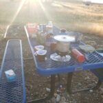
- We cooked outside.
Little Rockies in the north in this photo. The Lewis and Clark Expedition thought they were the Rockies.
Other trails lace the Reserve. The Upper Missouri River Breaks are west and the Charles M. Russell Wildlife Refuge is south of the American Prairie Reserve with trails.
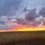
The evenings were delightful. Gorgeous sunsets glowed for hours. And in the dark sky, a jillion stars shone brightly. We saw constellations we hadn’t seen in years.
- Sunsets linger in the open West.
- Beginning of the Rockies.
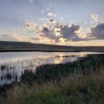
- Birds flock to wetlands.
Munching in Malta Montana
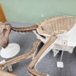
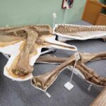
We enjoyed the tiny, totally packed general store in Zortman hamlet. (3-4 of everything!) We circled the Bowdoin National Wildlife Refuge, a treasure of lakes and wetlands. Here is a sanctuary for resident and migratory birds, many new to us. The water in the area is managed to maintain the lakes and an abundance of artificial islands were established to protect the nesting birds from predators. Stretch’s Pizza in Malta, MT, offered up some of the best vegetarian pizza ever. A welcome change from camp food and one of only two restaurant meals of our trip. The comprehensive Phillips County Museum in Malta gave major space with empathetic attention to both Native people and settlers. Absolutely a not-to-miss stop. And, of course, there was Elvis, the dinosaur, so named because of its perfectly articulated hips, found near Malta.
- Montana houses many ancient artifacts.
- The hips swivel like Elvis
After three days at and near APR we headed up to US Highway 2 and Fort Peck. Again, our National Passes helped with expenses. A lovely camping spot below the dam along the Missouri River boasts trails in every direction.
Fort Peck
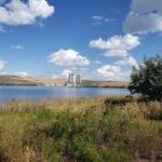
Fort Peck Dam is the largest hydraulic earth fill dam in the world, producing a billion kilowatts of electricity each year. You read it right, one billion. It was built in about seven years during the Great Depression but hydroelectric production didn’t get started until the early 1950s. It is 21,000 feet long.
- Trails radiate out from the campground.
- Billion kilowatt production
All along the Missouri River from the Breaks to Fort Peck area and around the reservoir is the Charles M. Russell Wildlife Refuge. It has sizable bison/buffalo herds. North of US Hwy 2 and east of the dam is the Fort Peck Indian Reservation where about 800 buffalo roam. We saw antelope, occasionally one but usually up to seven grazing in fields along with the cattle. American Prairie Reserve has the goal of preserving up to 300,000 acres of grassland in Montana which has one of only four sustainable grassland ecosystems in the world. The Reserve staff work with farmers to install wildlife-friendly fences, which have a more flexible, non-barbed wire on the bottom for antelope to cross under safely.
Into the Dakotas
Next, we headed east to North Dakota, and an unusually named town, Home on the Range. Every mile was a feast for the eyes as we drove through the Painted Canyon in Theodore Roosevelt National Park (TRNP) before heading to the south camping unit.
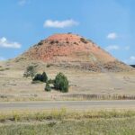
- Western North Dakota sports splendid colors.
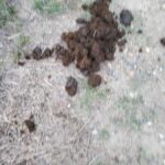
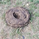
- Animal droppings
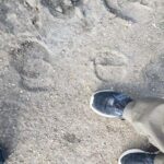
- compare the sizes!
- Bison make themselves known.
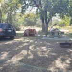
We managed to snag one of the last two camping spots. The wild horses, buffalo, antelope, and elk can all venture into the camping area. We saw evidence of the first two right near our camping spot. Five of the horses thought they might make a visit but campers steered them back into the wilds.
On our way to hike the Paddock Rim trail in the morning, we passed Sagamore Hill, Teddy Roosevelt’s Summer White House. Wild horses grazed in the distance. Bruce compared his foot size to buffalo hoof prints.
Prairie dog towns stretched as far as the eye could see in all directions. These chubby critters were grazing away, fattening up, and storing food for the winter as they do not hibernate. They were less wary than the ones on the American Prairie Reserve.
Agriculture and Open Range
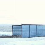
As we drove through Montana, North Dakota, and northern South Dakota, I could not believe how many hay bales in fields and the enormous stacks and rows of bales we saw. We understand they had an unusually rainy summer and so the harvest was plentiful and they will be selling a lot of hay south. We also saw many cattle storm shelters on the ranches, and huge corners of metal or wood on the west and north for cattle to shelter if they get caught in the field during snowstorms. Here is a stock image of a shelter. The ones we saw were 2-4 times this big on a side to shelter a large herd and probably some wildlife, too.
- Prairie Dogs
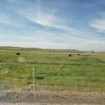
- Enormous hay bales
- Cattle can huddle in the enclosures in bad storms.
Black Hills
On south to the Black Hills where we camped near Deadwood with the hills behind and mule deer in the campground.
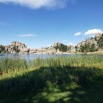
The next day we circled lovely Sylvan Lake which was one of Bruce’s Aunt Gertrude’s favorite spots.
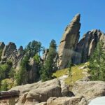
Having seen Rushmore several times with Gertrude, we chose the Needles Highway with plenty of crazy drivers.
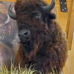
Custer Park carefully maintains a herd of about 1400 buffalo so the land is not overgrazed. We visited the buffalo center and learned a mountain of new information and met “Bob” the buffalo.
- A favorite spot in the Black Hills
- Custer State Park maintains a herd of bison
- spires of the Needles Highway
We headed south to Wind Cave National Park to camp and saw buffalo coming down the hill as we ate supper. With an approaching storm perhaps they were heading to shelter.
Our camp was somewhat sheltered by a hill but we endured the most vivid storm with constant lightning and thunder, and pounding rain we have ever experienced in our tent. Not the windiest but certainly the loudest and most vivid. Obviously, we survived and surprisingly stayed dry. Running to the car would have been deadly.
- A fierce storm sent bison to shelter
- Bison
- Storms kick up quickly in the west.
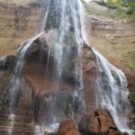
Our last camping spot before we headed to our farm was on the Niobrara River at Smith Falls State Park near Valentine, Nebraska. What a lovely night with the river rippling by. Smith Falls, is privately owned. However, the owner put in his will a permanent lease to the state so that visitors could experience this treasure. The hike and falls are quite stunning and the state has ensured that anyone can access this special place — totally handicapped accessible.
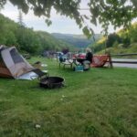
- Most meals we prepared in camp.
- This private falls is open to the public.
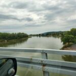
- We followed and crossed the Missouri River many times.
So, we arrived back in Iowa, realizing we had seen many sections of the Missouri River along the way.


Nice job, as always. I once drove I-90 from Seattle to (eventually) Omaha and also one time through the badlands on my visit to Yellowstone from Des Moines. Both were memorable trips. Also have driven a big chunk of route 66, getting on it in Missouri. Great fun that entire trip and many lifetime memoriess. We stay at KOA campgrounds on most of our road trip travels.
I have a video of part of my route 66 trip and can email it to you if you wish. I go way back with the Pattersons to the times when you were part of the Indian Creek Nature Center. Have walked the Sac and Fox trail many times and the Cedar Valley NatureTrail clear up to Hwy 20 and back a few times, I also have a video titled Eastern Iowa Walkabout and would be happy to share that with you, too. BTW, my bucket list includes driving the length of the Lincoln Hwy, from New Jersey to Oregon. Best to you.
Thanks. We are good for now so no need to send videos.