by Winding Pathways | Jan 11, 2024 | Travel/Columns, Wonderment
What did I do yesterday morning? Did I make it to that meeting last Monday? Darn. I can’t remember. I’m forgetful. Fortunately, my journal writing isn’t.
18,250 days
Every day since April 1973 I’ve written a simple journal entry on small format lined binder paper. Haven’t missed a single day. Entries aren’t great writing and are rarely emotional. It’s not a diary. On some days I write only a few lines, while I might fill a page on more happening days.
My journal records about 18,250 days of my life. Combined notebooks take up about three feet of shelf space.
Uses of Journaling

Journals
Useful? Yup. When did we go to Yellowstone National Park? I remembered the month and year but not the dates. In minutes I found those dates in my notebook and learned what we did each day. What did we do on Christmas Eve 18 years ago? My journal reminds me.
My notes are simple, short, and often skip perfect grammar, but they are meant to bring every day into clear memory………so each journal entry records something distinctive about that day. Here’s a simple entry:
Monday, January 16, 2023: Weirdly warm with temperature in the 50s. Made new plywood shelves for my tool cabinet. Payton (a neighbor kid) was visiting when sirens blew warning of a potential tornado. We sheltered in the basement. No tornado here but one hit near Williamsburg, the first January tornado in Iowa since 1967.
Like Brushing Teeth
I’ve been journaling for so long it is as routine as brushing my teeth. Blank journal paper goes with me on trips, and I’ve even scribbled entries by lantern light at campgrounds.
My memory lapses. My journal never does.
What are Ways YOU Remember?
People have other ways to remember or “journal.” Share some and we can post on Winding Pathways
by Winding Pathways | Nov 16, 2023 | Nature, Travel/Columns
Lynyrd Skynyrd Tribute
“Sweet Home Alabama” by Lynyrd Skynyrd is a “heartfelt tribute to the state of Alabama.” Adopted by Alabama tourism as its slogan the “catchy” phrase indeed speaks to the variety and comfort of this truly Southern Hospitality state.
On a hot and muggy September trip to the deep South, we experienced Alabama hospitality and diversity from north to south.
Surprising Diversity
The northern third of Alabama is rugged where the Appalachian Mountains swing in from the northeast and finger down southwest toward the center of the state. The Tennessee River flows from Knoxville, TN, then cuts northwest through Huntsville and Decatur and on into the Tennessee Valley Authority. It’s wet there and tent camping is an adventure when the waters run high. We quickly learned that most of the waterways flow south and spill eventually into the Gulf. Planning our crossings was important because there are limited bridges from west to east.
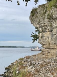
Quick way to cross the Ohio
Further north we did ferry across the Ohio at Cave in Rock, IL. This working ferry gets local and distance travelers across the broad river. The sounds of the ferry clanging and moaning of chains and engines at night recalled Jurassic Park! Then we wound our way through Kentucky and Tennessee to Alabama following parts of the Natchez Trace and the Trail of Tears.
Geologically, the ancient Appalachians of northern Alabama boast caverns, natural bridges, and tumbling waterways with falls. Cooler mountain air and vistas delight weary travelers’ eyes.
Birders find diverse birding from the endangered Red-cockaded Woodpecker that thrives in mature pine forests to the Bald Eagles that seem to soar everywhere nonplussed by humans. Nearer the coast migrating birds rest from their long flight over the Gulf. The State promotes varied birding trails.
Culturally, The Poarch Creek Indians hold Alabama sacred and are the only federally recognized Indian Tribe in the state. The Helen Keller home in Sheffield and Huntsville’s U.S. Space and Rocket Center are great stops.
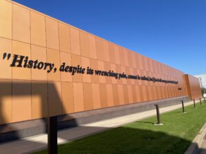
This unusual phrase refers not to martial arts but to fertile calcareous soils that span central Alabama. Here, farming in plantations dominated. This region is also where the Civil Rights movement of the ‘60s. Montgomery hosts the new Legacy Museum that powerfully retells the story of kidnapped Africans who became slaves on plantations and the unjust, centuries-long suppression and incarceration of people. Along with The National Memorial for Peace and Justice, this important, interactive museum holds accountable past injustices and opens the door for reconciliation and cultural change where we ALL can be better people.
-
-
A sober and important museum of history.
-

-
Blend of new and old
The Coastal Shores
The drive through large swaths of timber-harvested pine forests revealed a source of the nation’s telephone poles. So, thank Alabama’s logging industry the next time you pass a pole. Our destination was Gulf Shores State Park and Lodge where we explored for three days. The Lodge is LEED certified and surrounding modern “cabins” and RV camping accommodate most budgets. How smart of the state to get this piece of Gulf land. It is one of the few areas not privately developed and with views of the Gulf waters. With miles of bicycle trails, fresh, brackish, and salt-water areas, and white sugar sand beaches, it is totally enjoyable. The habitat changes in a short distance depending on elevation (yes there is elevation along the coast) and proximity to the Gulf. We bicycled past freshwater ponds, palmetto areas, oak knobs, and back to beach habitat.
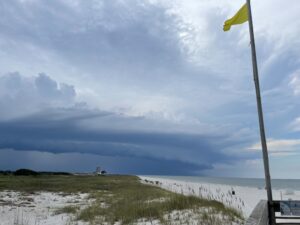
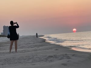
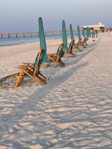
Lots for most people to take in. Our favorite was walking after dark along the shore looking for the ghost crabs. Herons stalked nearby, also on the hunt. Dawn found us sitting quietly along with others watching the sun rise over the Gulf. Each day crews set out and took in beach chairs and umbrellas. Flags flutter in strategic places alerting visitors to water conditions. During our stay, small yellow flags rippled in stiff winds. Rip currents are a thing to pay attention to.
-
-
Weather changes rapidly along the Gulf.
-
-
Quiet time at sunrise in Sweet Home Alabama
-
-
Ready for beach goers.
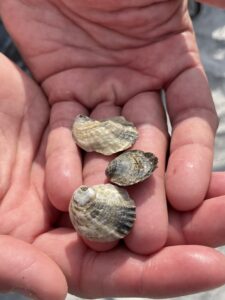
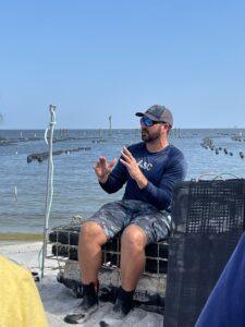
Rich took in a day fishing trip out of sight of land learning more about Gulf waters, sea bed, and the fishing industry. Marion took in oyster harvesting. Owners of Admiral Shellfish and Navy Cove shared the aquaculture techniques to raise oysters from pinpoint size to eating size in a matter of months. In northern waters, it’s years before edible oysters can be harvested. We both enjoyed several meals of oysters – who got the raw end of the deal!
-
-
Gulf oysters
-
-
Protected waters make excellent habitat for oysters.
Lodging & FOOD!
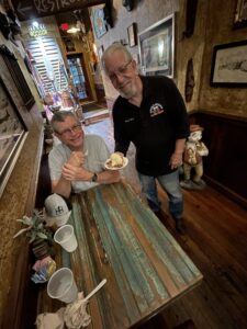
Uncle Mick’s Cajun old town Prattville is THE place to eat Southern.
We can’t say enough about Sweet Home Alabama hospitality and food. The front desk staff at the Hampton Inn and Suites, Prattville, AL, are some of the most friendly, efficient, and kind service workers we have ever met. They guided us to Uncle Mick’s Cajun just down the road in old town Prattville. The unique and tasty dishes and personal touches by the owner made the meal memorable. Staff kept dishing up small portions of truly Southern food for us to try and then loaded on our choices. Uncle Mick himself visited and drawled, “Would you like the pecan pie warmed up?” Well, yes. “How about a scoop of our local vanilla ice cream?” Well, yes. “And we’ll pour over warm bourbon sauce. If you’d like.” Well, YES! All at no extra charge. Amazing!
At Gulf Shores, the Flying Harpoon is truly local. Unpretentious, funky, and busy! Eating our po boys, and shrimp baskets, and sipping a local brew we chatted with servers and residents. Down the road tourists dined at the “recommended” upscale restaurants.
One of our most curious adventures was the luxury RV water park Tropic Falls at OWA. Not much natural there, but a great time watching huge buckets fill with water and splash down soaking nearby visitors. It was hot so that was fine! Tropical falls and dizzying roller coaster rides were two hits along with mermaids serving beverages and food. Quite the place. Be ready to spend money.
Back up through pine forests, skirting rivers, crossing the Ohio and Mississippi Rivers, and on into familiar Midwest terrain. We carry memories and stories with us.
by Winding Pathways | Nov 2, 2023 | Travel/Columns
West to Montana
This September, after a more normal Cedar Rapids year (post-derecho, post-COVID, post-surgeries) we headed to the American Prairie Reserve in Montana which we help support. Our compact equipment fit nicely in the Subaru as we headed out on Highway 30. That gave us a great view of wind turbines, especially in western Iowa. We threaded our way up to and through Sioux City to I-90 and crossed South Dakota, pausing at eye-catching rest stops.
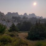
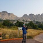
The Badlands were smoky from Canadian wildfires the first night we camped but cleared some by the next morning. The spacious tent sites were pleasant, and our lifetime National Park senior passes came in handy.
-
-
Canadian wildfire smoke.
-
-
Smoke drifted off overnight.
-

-
Author “visiting” with wooden Wall Drug statue.
We enjoyed the Badlands loop and then just had to stop at iconic Wall Drug and walk through without succumbing to the enticements. We didn’t get ice water but had coffee instead.
The Bighorns in Wyoming.
Such unusual names like Crazy Woman Creek and the Tongue River, had us speculating what might be behind those names. As we passed through the Crow Reservation we thought about the contrasts between Reservation land, with less arable soil, and non-Reservation lands and settlements. The Crow land is large. We noticed some fields with square bales compared to the large, round bales on non-reservation ranches.

The Bighorns loom in the distance.
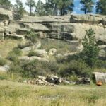
The second night found us camping in a private campground in southeast Montana north of the reservation. Most private campgrounds are geared toward huge RVs and camping trailers, with few tent spaces. However, we secured a tent spot by a stream and enjoyed showers.
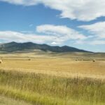
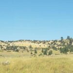
The land changed radically in Montana. Rocky hills with huge hayfields, grazing cattle, and beehives dominated. We saw some sorghum and sunflower fields.
-
-
Montana is a mix of agriculture and steep hills.
-
-
Tenting among rocks.
-
-
Montana’s varied landscape
American Praririe Reserve
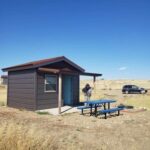
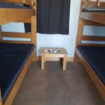
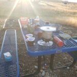
We headed west and then north on US 191 to our cabin on the American Prairie Reserve (APR). Small cabins with bunk beds and storage space were seven miles north of the Missouri River. Although we have tent camped many times in bear and cougar country, we were glad to have a rustic cabin. Along with four cabins, there were also about twelve primitive camping sites. We cooked outside.
The well for potable water, with high mineral content, was 2,000 feet deep. We used community showers, toilets, two sinks, and a dishwashing sink/drainer which were very thoughtfully spaced and planned. By hiking trails near the cabins, we learned about prairie ecosystems – grasslands, soil and water, bugs, birds, and animals. As we hiked around the area, prairie dogs gave us hell every time, pipping like crazy. Plenty of scat and some bear paw prints confirmed we were glad to have a cabin to stay in.
-
-
Several huts and rustic camp spots invited visitors.
-
-
The tiny cabin kept us warm.
-
-
We cooked outside.
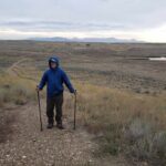
Little Rockies in the north in this photo. The Lewis and Clark Expedition thought they were the Rockies.
Other trails lace the Reserve. The Upper Missouri River Breaks are west and the Charles M. Russell Wildlife Refuge is south of the American Prairie Reserve with trails.
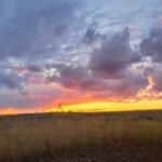
The evenings were delightful. Gorgeous sunsets glowed for hours. And in the dark sky, a jillion stars shone brightly. We saw constellations we hadn’t seen in years.
-
-
Sunsets linger in the open West.
-
-
Beginning of the Rockies.
-
-
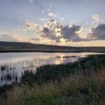
Birds flock to wetlands.
Munching in Malta Montana
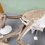
We enjoyed the tiny, totally packed general store in Zortman hamlet. (3-4 of everything!) We circled the Bowdoin National Wildlife Refuge, a treasure of lakes and wetlands. Here is a sanctuary for resident and migratory birds, many new to us. The water in the area is managed to maintain the lakes and an abundance of artificial islands were established to protect the nesting birds from predators. Stretch’s Pizza in Malta, MT, offered up some of the best vegetarian pizza ever. A welcome change from camp food and one of only two restaurant meals of our trip. The comprehensive Phillips County Museum in Malta gave major space with empathetic attention to both Native people and settlers. Absolutely a not-to-miss stop. And, of course, there was Elvis, the dinosaur, so named because of its perfectly articulated hips, found near Malta.
-
-
Montana houses many ancient artifacts.
-
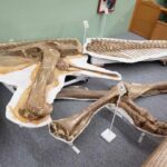
-
The hips swivel like Elvis
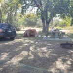
After three days at and near APR we headed up to US Highway 2 and Fort Peck. Again, our National Passes helped with expenses. A lovely camping spot below the dam along the Missouri River boasts trails in every direction.
Fort Peck
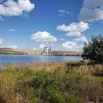
Fort Peck Dam is the largest hydraulic earth fill dam in the world, producing a billion kilowatts of electricity each year. You read it right, one billion. It was built in about seven years during the Great Depression but hydroelectric production didn’t get started until the early 1950s. It is 21,000 feet long.
-
-
Trails radiate out from the campground.
-
-
Billion kilowatt production
All along the Missouri River from the Breaks to Fort Peck area and around the reservoir is the Charles M. Russell Wildlife Refuge. It has sizable bison/buffalo herds. North of US Hwy 2 and east of the dam is the Fort Peck Indian Reservation where about 800 buffalo roam. We saw antelope, occasionally one but usually up to seven grazing in fields along with the cattle. American Prairie Reserve has the goal of preserving up to 300,000 acres of grassland in Montana which has one of only four sustainable grassland ecosystems in the world. The Reserve staff work with farmers to install wildlife-friendly fences, which have a more flexible, non-barbed wire on the bottom for antelope to cross under safely.
Into the Dakotas
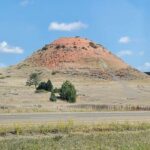
Next, we headed east to North Dakota, and an unusually named town, Home on the Range. Every mile was a feast for the eyes as we drove through the Painted Canyon in Theodore Roosevelt National Park (TRNP) before heading to the south camping unit.
-
-
Western North Dakota sports splendid colors.
-

-
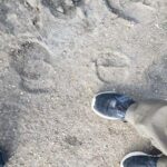
Animal droppings
-
-
compare the sizes!
-

-
Bison make themselves known.
We managed to snag one of the last two camping spots. The wild horses, buffalo, antelope, and elk can all venture into the camping area. We saw evidence of the first two right near our camping spot. Five of the horses thought they might make a visit but campers steered them back into the wilds.
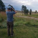
On our way to hike the Paddock Rim trail in the morning, we passed Sagamore Hill, Teddy Roosevelt’s Summer White House. Wild horses grazed in the distance. Bruce compared his foot size to buffalo hoof prints.
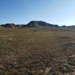
Prairie dog towns stretched as far as the eye could see in all directions. These chubby critters were grazing away, fattening up, and storing food for the winter as they do not hibernate. They were less wary than the ones on the American Prairie Reserve.
Agriculture and Open Range
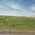
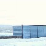
As we drove through Montana, North Dakota, and northern South Dakota, I could not believe how many hay bales in fields and the enormous stacks and rows of bales we saw. We understand they had an unusually rainy summer and so the harvest was plentiful and they will be selling a lot of hay south. We also saw many cattle storm shelters on the ranches, and huge corners of metal or wood on the west and north for cattle to shelter if they get caught in the field during snowstorms. Here is a stock image of a shelter. The ones we saw were 2-4 times this big on a side to shelter a large herd and probably some wildlife, too.
-
-
Prairie Dogs
-
-
Enormous hay bales
-
-
Cattle can huddle in the enclosures in bad storms.
Black Hills
On south to the Black Hills where we camped near Deadwood with the hills behind and mule deer in the campground.
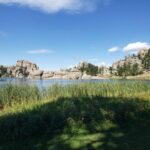
The next day we circled lovely Sylvan Lake which was one of Bruce’s Aunt Gertrude’s favorite spots.
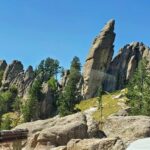
Having seen Rushmore several times with Gertrude, we chose the Needles Highway with plenty of crazy drivers.
Custer Park carefully maintains a herd of about 1400 buffalo so the land is not overgrazed. We visited the buffalo center and learned a mountain of new information and met “Bob” the buffalo.
-
-
A favorite spot in the Black Hills
-

-
Custer State Park maintains a herd of bison
-
-
spires of the Needles Highway
We headed south to Wind Cave National Park to camp and saw buffalo coming down the hill as we ate supper. With an approaching storm perhaps they were heading to shelter.
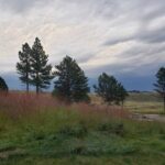
Our camp was somewhat sheltered by a hill but we endured the most vivid storm with constant lightning and thunder, and pounding rain we have ever experienced in our tent. Not the windiest but certainly the loudest and most vivid. Obviously, we survived and surprisingly stayed dry. Running to the car would have been deadly.
-
-
A fierce storm sent bison to shelter
-
-
Bison
-
-
Storms kick up quickly in the west.
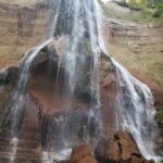
Our last camping spot before we headed to our farm was on the Niobrara River at Smith Falls State Park near Valentine, Nebraska. What a lovely night with the river rippling by. Smith Falls, is privately owned. However, the owner put in his will a permanent lease to the state so that visitors could experience this treasure. The hike and falls are quite stunning and the state has ensured that anyone can access this special place — totally handicapped accessible.
-
-
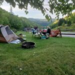
Most meals we prepared in camp.
-
-
This private falls is open to the public.
-
-
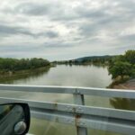
We followed and crossed the Missouri River many times.
So, we arrived back in Iowa, realizing we had seen many sections of the Missouri River along the way.
by Winding Pathways | Sep 14, 2023 | Mammals, Nature, Travel/Columns
We were recently amazed to learn that Pennsylvania has a thriving herd of wild elk.
A couple of times each year we make the long drive from our Iowa home to visit relatives in New Jersey. We traverse Pennsylvania on Interstate 80. For years we’ve been intrigued by interesting and unusual town names we see on roadside signs. Jersey Shore, Mountain Top, and Snow Shoe are examples.
As we approached mid-Pennsylvania recently heading back to Iowa, we tired of the big semi-truck-filled road. So we exited at the tiny town of Snow Shoe and followed smaller paved roads through the forests and clearings of Moshannon State Forest. We soon reached the hamlet of Benezette, the epicenter of Pennsylvania’s wild elk herd.
Thanks to a stop at the visitor center of the Keystone Elk Country Alliance we learned the fascinating story of this massive deer’s return to an area called the Pennsylvania Wilds.
Where Elk Once Trod
When Columbus made landfall wild elk roamed much of what became the United States, even close to the Atlantic Ocean’s shore. Such tasty and large animals had little chance against explosive human population growth and the conversion of wild lands to farms, ranches, roads, and urban areas. By the late 1800s wild elk only lived in wild areas in the Rocky Mountain States.
Fortunately, that’s changed. Now there are wild elk herds in at least 19 states, including Michigan, Minnesota, West Virginia, Missouri, Arkansas, and North Carolina. Kentucky has the largest wild elk herd east of the Rockies with at least 13,000 of the massive deer roaming the state.
How It Happened
In 1912 a shipment of elk was trained from Yellowstone National Park to Pennsylvania and released in the north-central part of the state. It was joined by some animals from a private herd and further releases a few years later. The herd stayed small for years but began expanding during the past few decades. Today about 1,400 wild elk roam the area.
We loved our day in the Benezette area. The lands are managed so large patches of open woods allow visitors to see into the forests hoping to spot elk. It was hot, so the elk were somewhere deep in the shady woods. We didn’t see any but enjoyed learning more in the impressive museum. Then, we walked area trails looking for signs of elk – droppings, and rubs. Hot and thirsty, we stopped at the Elk Life Store for elk hot dogs and a cool beverage. Tasty and with great views. The hills shimmered in the light and streams coursed down the draws and valleys.
Elk bring tourists to the Benezette area. Small lodges, bed and breakfasts, and Airbnb’s abound. The most popular time is fall when male, or bull, elk bugle. Make lodging reservations well in advance. For information contact Keystone Elk Country Alliance.
-
-
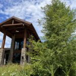
The Keystone Elk Country Land is a cooperative among agencies.
-
-
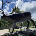
Gracing the entry
-

-
We enjoyed an elk dog and beverage.
-
-
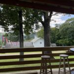
Rolling hills and small shops characterize Elk Country.
Pennsylvania’s Not Alone
Thanks to the efforts of state wildlife agencies, the Rocky Mountain Elk Foundation, volunteers, and financial donors elk are thriving in many states. Read where elk live. And, for a map, check out the Izaak Walton League’s site.
We even have about 15 elk in Iowa. They’re at the Neal Smith National Wildlife Refuge near Prairie City east of Des Moines.
A trip to Wyoming, Colorado, or Idaho offers wonderful chances to see elk, but elk can be seen far and wide across the Eastern United States.
by Winding Pathways | Aug 31, 2023 | Geology/Weather, Travel/Columns, Trees/Shrubs
Travels this summer showed how varied the North American continent’s vegetation, landscape, and weather are. Most recently we have journeyed from New Jersey to Southern Saskatchewan. Vegetation and terrain could not be more different.
Venturing from “Wide Open Spaces” to “Into the Woods”
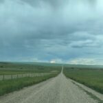
Native forbs and grasses cover the land.
The Dixie Girls’ refrain “Wide Open Spaces” describes the terrain we drove through in Southern Saskatchewan. One day Rich hiked to a high spot in Grasslands National Park. Beneath and beyond him were thousands of acres of grasslands – forbs and native grasses. Nary a tree poked upward in this vast and beautiful land.
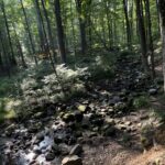
Brook waters tumble over rocks.
In contrast “Into the Woods” by Sondheim and Lapine would better characterize the roadside woods as our car approached New Jersey six weeks later. Jersey’s woods are so dense and thick that little sunlight filters through the leafy crown. On wood edges, impenetrable tangles of shrubs, brambles and vines seem to be everywhere.
Goldilocks Zone
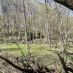
Iowa’s woodlands tend to be more open than eastern woods.
True to its location in “middle America,” our home in Eastern Iowa fits somewhere in between. You might say it is the “Goldilocks Zone” of vegetation. Midwestern woods tend to be more open than New Jersey’s but dense compared with Saskatchewan’s few low brushy areas. Iowa’s neither wide open nor dense but somewhere in between. It’s like a hybrid.
Location, Location, Location
What makes such a striking difference in vegetation extremes? These numbers tell part of the story:
Location Annual Precipitation Annual Mean Temp Wind
Saskatchewan 14” 39 F often and strong
New Jersey 54” 48 F calm to light
Iowa ranges in the middle with an average of 36” of precipitation.
Numbers don’t tell it all. New Jersey’s climate is moderated by the ocean, so the hottest temperature ever recorded near Rich’s hometown of Denville was 104 degrees Fahrenheit, and the coldest was -21. That’s a 125-degree variance. In Val Marie, Saskatchewan, the highest temperature ever recorded was 113 degrees Fahrenheit, and the lowest was -70. That’s a whopping 183-degree variance.
When we visited Val Marie, Saskatchewan, on the summer solstice, the sun was brilliant, the breezes gentle, and the night air cool. Sunsets lingered and the moon seemed to pop over the horizon and grace the landscape all night. Recently, thick smoke from wildfires blanketed the province like it has in Iowa and temperatures soared.
We hit New Jersey just right with warm day temperatures, a slight south breeze, tolerable humidity, and evenings that cooled down. The wildfire smoke had moved out. We were fortunate both times.
There’s more
Saskatchewan is much further north than New Jersey, so it receives significantly more summer light and much less sunlight in winter. Generally, Saskatchewan enjoys low humidity, while Jersey sweats in humid air year-round.
These differences in light and temperature plus topography, soil type, and the way people manage the landform its appearance and determine what species of plants and wildlife can exist there.
We noticed that people who live in the thickly wooded East are sometimes uncomfortable when traveling in the West’s wide-open spaces and Westerners feel claustrophobic amid the thick growth in the East. Comfort levels vary with the terrain.
Commonality
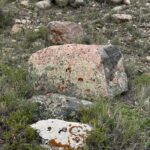
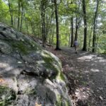
Both Saskatchewan and New Jersey do share a common feature. Rocks! Everywhere are pebbles, rocks, and boulders. Saskatchewan was glaciated and rocks, carried in by sheets of ice, litter the fields. Piles dot the fields where ranchers and farmers have piled them so they can till the sandy-type soil. New Jersey’s rocks are often bedrock with glacial striations and miles of rock and stone walls.
-
-
Lichen-covered boulders
-
-
New Jersey’s inland landscape is defined by boulders.
What’s the difference between a rock wall and a stone wall? Well, there really isn’t. Both are made of rocks. But some, like rounded glacial rocks, were hauled from fields and tossed into rows to make boundaries. It takes a lot of work to maintain them. As Robert Frost stated in one poem, “Good fences make good neighbors.”
Others, flatter rocks like slate and shale, are easier to fit together. Marion’s dad was a stone worker crafting rock walls, carefully choosing rocks to fit well together. These rock walls stand for decades. At any rate, both Saskatchewan and New Jersey have an abundance of rocks that influence how land is used.
One of our traveling pleasures is noting vegetation and topography through our car’s windows, even as we speed along. To us, all places are interesting, and no matter what the terrain and vegetation we’re passing through it’s fascinating.
by Winding Pathways | Jul 27, 2023 | Nature, Travel/Columns, Trees
Always Something New To Learn
Although we’ve lived in Iowa for over 40 years, we never knew so much history crowded into a small town in the mid-1800s not long after settlement. Our visit to the Lewelling Quaker Museum in Salem, Iowa, brought us up to speed on history. The small museum tells a fascinating, little-known history that impacted people far beyond Iowa’s borders. They focus on three significant areas.
Quakers
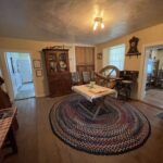
The Museum’s formal name is the Lewelling Quaker Museum. These peaceful people moved to the area during the decades prior to the Civil War. Among their many beliefs was a strong aversion to slavery. Neighboring Missouri settlers owned slaves just 20 miles south of Salem.
-
-
Decorated in the era of the 1800s.
-

-
_Note Height Difference
-

-
Way to make music
The Underground Railroad
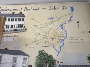
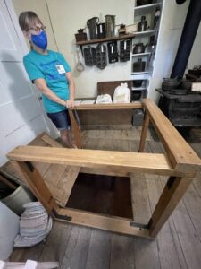
Salem area Quakers, joined by others of various faiths, were a significant part of the Underground Railroad that helped escaped slaves move north to legal safety in Canada. In the museum, located in an old home, we were able to enter the tiny crawl space beneath the kitchen where slaves hid from slave catchers. The process must have been scary for both slaves and those who helped them. Captured slaves were returned to their owner for likely punishment and continued to live in bondage. Whites who helped risked arrest and incarceration. Yet, the Underground railroad persisted and helped many people gain freedom.
-
-
Salem was a major depot.
-
-
A rug and kitchen table covered the closed trap door.
Fruit
The Lewelling Family were nursery people who cultivated and sold fruit trees. They developed several productive varieties of cherries and apples. In the early days of the Oregon Trail travel fever infected the Lewellings. They modified a wagon to hold tiny fruit tree slips and made the arduous trek over the Great Plains and mountains all the way to the Willamette Valley. Most of the baby trees survived the trip and were used to start the Pacific Northwest’s famed fruit industry. People enjoy different fruits and apple varieties to this day in part because of the families that carried the tiny fruit slips west.

18″ thick walls.
The volunteer-operated Lewelling Quaker Museum is open for tours Sunday afternoons from 1-4 pm May through September and by appointment at other times and dates. We found our visit fascinating and encourage others to go. Salem is located a few miles south of Mount Pleasant, Iowa, in the SE corner of the state. For information check lewelling.org.


